| Item Detail |
| |
| |
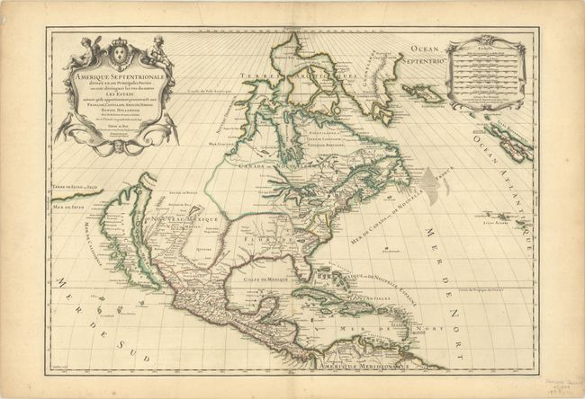
MapMaker: |
Sanson/Jaillot
|
|
| |
| |
Subject: |
Colonial North America |
|
| |
Period/Size: |
1698 / 18.0" x 25.4" (45.8 x 64.6 cm)
|
|
| |
Color: |
Colored
|
|
| |
Condition: |
(A) Nice dark impression with a small spot south of Cuba, a printer's crease in the Arctic, and light toning along the edges of the sheet. There are minor ink notations in several place names that do not distract. (condition help) |
|
| |
Source: |
L'Atlas Francois |
|
| |
References: |
Burden #709; McCorkle #695.4; McLaughlin #101; Tooley (Amer.) p. 121, #37. |
|
| |
|
|
| Sales Information |
| |
| |
Price: |
|
|
| |
| |
Offered by: |
Old World Auctions |
|
| |
Catalog: |
Auction No. 191 - Antique Maps, Charts, Atlases & Globes (9561) |
|
| |
Lot/Item #: |
95 |
|
| |
| |
Date: |
02/2023
|
|
| |
| |
|