Title:
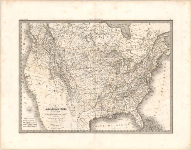
“Carte des Etats-Unis d'Amerique, du Canada, du Nouveau Brunswick et d'une Partie de la Nouvelle Bretagne”
Map Maker:
Alexander Emile & Pierre Lapie
This is a great map filled with detail, Indian tri... (full text available to subscribers)
| Item Detail |
| |
| |
MapMaker: |
Alexander Emile & Pierre Lapie
|
|
| |
| |
Subject: |
United States & Canada |
|
| |
Period/Size: |
1832 / 15.5" x 21.2" (39.4 x 53.9 cm)
|
|
| |
Color: |
Colored
|
|
| |
Condition: |
(B+) A dark impression with contemporary outline color on a bright sheet with light foxing mostly confined to the blank margins. Two folds in blank margins. (condition help) |
|
| |
Source: |
Atlas Universel |
|
| |
References: |
|
|
| |
|
|
| Sales Information |
| |
| |
Price: |
|
|
| |
| |
Offered by: |
Old World Auctions |
|
| |
Catalog: |
Auction No. 191 - Antique Maps, Charts, Atlases & Globes (9561) |
|
| |
Lot/Item #: |
124 |
|
| |
| |
Date: |
02/2023
|
|
| |
| |
|
Antique Maps - Valuation and Pricing, Descriptions, Resources |
|
Home |
Information |
Search |
Register |
Contact Us |
Site Map
Americana Exchange, Inc. © 1999 - 2024 Americana Exchange, Inc.. All rights reserved.
OldMaps.com, the OldMaps.com logo and
AMPR are service marks or registered service marks of Americana Exchange, Inc..
|