Title:
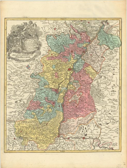
“Superioris Atque Inferioris Alsatiae Tabula Perquam Accurata et Exacta, Proximis Regionib. Incunde Huic Insertis, Annexisque: ex Conatibus”
Map Maker:
Tobias Conrad Lotter
This map is centered on Strasburg and follows the ... (full text available to subscribers)
| Item Detail |
| |
| |
MapMaker: |
Tobias Conrad Lotter
|
|
| |
| |
Subject: |
France & Germany, Rhine River |
|
| |
Period/Size: |
1760 / 22.1" x 19.2" (56.2 x 48.8 cm)
|
|
| |
Color: |
Colored
|
|
| |
Condition: |
(A) A sharp impression with full contemporary color on a bright sheet with slightly rippled paper in the top margin and minor toning along the edges of the sheet. (condition help) |
|
| |
Source: |
|
|
| |
References: |
|
|
| |
|
|
| Sales Information |
| |
| |
Price: |
|
|
| |
| |
Offered by: |
Old World Auctions |
|
| |
Catalog: |
Auction No. 191 - Antique Maps, Charts, Atlases & Globes (9561) |
|
| |
Lot/Item #: |
527 |
|
| |
| |
Date: |
02/2023
|
|
| |
| |
|
Antique Maps - Valuation and Pricing, Descriptions, Resources |
|
Home |
Information |
Search |
Register |
Contact Us |
Site Map
Americana Exchange, Inc. © 1999 - 2024 Americana Exchange, Inc.. All rights reserved.
OldMaps.com, the OldMaps.com logo and
AMPR are service marks or registered service marks of Americana Exchange, Inc..
|