| Item Detail |
| |
| |
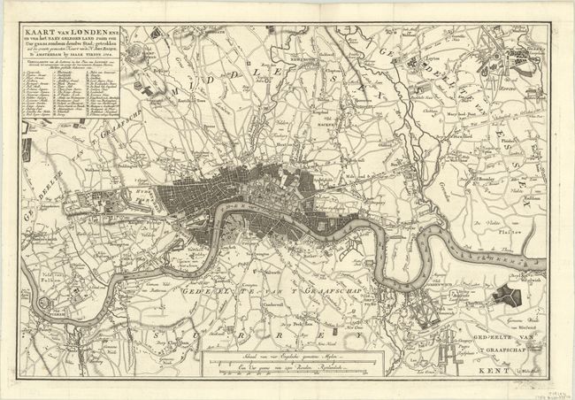
MapMaker: |
Isaac Tirion
|
|
| |
| |
Subject: |
London, England |
|
| |
Period/Size: |
1754 / 11.0" x 16.3" (28.0 x 41.4 cm)
|
|
| |
Color: |
Black & White
|
|
| |
Condition: |
(A+) A sharp impression on a bright sheet, issued folding with one unobtrusive spot at bottom left. (condition help) |
|
| |
Source: |
Hedendaagsche Historie of Tegenwoordige staat van Groot Brittannie |
|
| |
References: |
Howgego #102. |
|
| |
|
|
| Sales Information |
| |
| |
Price: |
|
|
| |
| |
Offered by: |
Old World Auctions |
|
| |
Catalog: |
Auction No. 191 - Antique Maps, Charts, Atlases & Globes (9561) |
|
| |
Lot/Item #: |
472 |
|
| |
| |
Date: |
02/2023
|
|
| |
| |
|