Title:
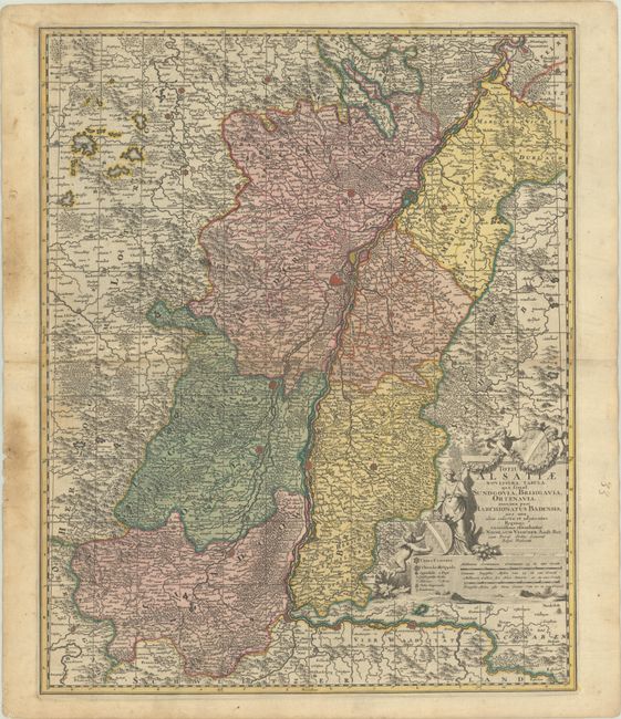
“Totius Alsatiae Novissima Tabula, qua Simul Sundgovia, Brisigavia, Ortenavia, Maxima Pars Marchionatus Badensis...”
Map Maker:
Nicolas Visscher
This elegantly engraved map centers on Strasburg a... (full text available to subscribers)
| Item Detail |
| |
| |
MapMaker: |
Nicolas Visscher
|
|
| |
| |
Subject: |
France & Germany, Rhine River |
|
| |
Period/Size: |
1700 / 22.5" x 18.1" (57.2 x 46.0 cm)
|
|
| |
Color: |
Colored
|
|
| |
Condition: |
(B+) A sharp impression in contemporary color with light soiling, the majority of which is confined to the blank margins. Short edge tears in the left blank margin have been backed on verso with old paper. (condition help) |
|
| |
Source: |
|
|
| |
References: |
|
|
| |
|
|
| Sales Information |
| |
| |
Price: |
|
|
| |
| |
Offered by: |
Old World Auctions |
|
| |
Catalog: |
Auction No. 191 - Antique Maps, Charts, Atlases & Globes (9561) |
|
| |
Lot/Item #: |
526 |
|
| |
| |
Date: |
02/2023
|
|
| |
| |
|
Antique Maps - Valuation and Pricing, Descriptions, Resources |
|
Home |
Information |
Search |
Register |
Contact Us |
Site Map
Americana Exchange, Inc. © 1999 - 2024 Americana Exchange, Inc.. All rights reserved.
OldMaps.com, the OldMaps.com logo and
AMPR are service marks or registered service marks of Americana Exchange, Inc..
|