Title:
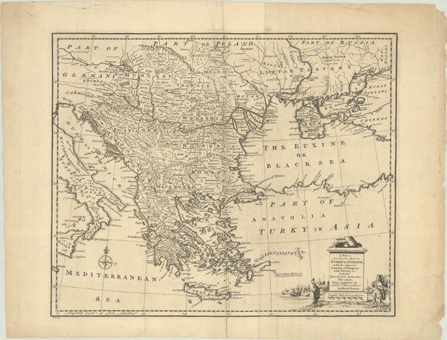
“A New & Accurate Map of Turky in Europe, with the Adjacent Counties of Hungary, Little Tartary &c...”
Map Maker:
Emanuel Bowen
Detailed copper engraved map of the Balkans, exten... (full text available to subscribers)
| Item Detail |
| |
| |
MapMaker: |
Emanuel Bowen
|
|
| |
| |
Subject: |
Balkans |
|
| |
Period/Size: |
1747 / 13.8" x 16.7" (35.1 x 42.5 cm)
|
|
| |
Color: |
Black & White
|
|
| |
Condition: |
(B+) A dark impression, issued folding with light soiling and archival repairs to a few separations and small holes. (condition help) |
|
| |
Source: |
A Complete System of Geography |
|
| |
References: |
McCorkle (18th C. Geography Books) #17-1 (Vol II); cf. Shirley (BL Atlases) T.BOW-2a #31. |
|
| |
|
|
| Sales Information |
| |
| |
Price: |
|
|
| |
| |
Offered by: |
Old World Auctions |
|
| |
Catalog: |
Auction No. 191 - Antique Maps, Charts, Atlases & Globes (9561) |
|
| |
Lot/Item #: |
598 |
|
| |
| |
Date: |
02/2023
|
|
| |
| |
|
Antique Maps - Valuation and Pricing, Descriptions, Resources |
|
Home |
Information |
Search |
Register |
Contact Us |
Site Map
Americana Exchange, Inc. © 1999 - 2024 Americana Exchange, Inc.. All rights reserved.
OldMaps.com, the OldMaps.com logo and
AMPR are service marks or registered service marks of Americana Exchange, Inc..
|