| Item Detail |
| |
| |
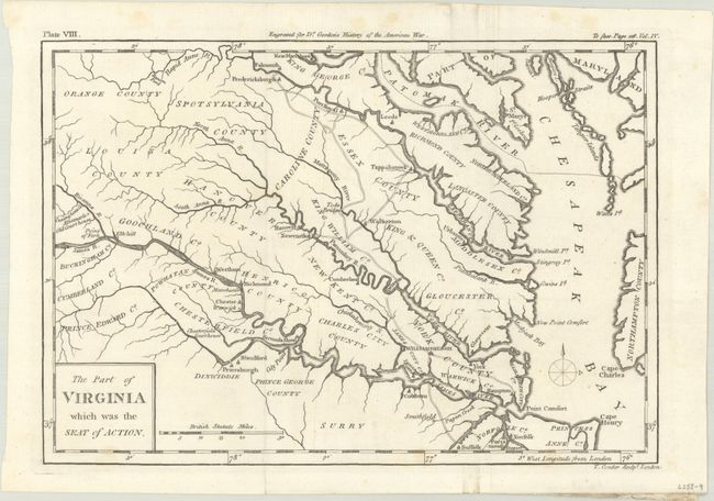
MapMaker: |
Thomas Conder
|
|
| |
| |
Subject: |
Eastern Virginia |
|
| |
Period/Size: |
1788 / 7.2" x 10.4" (18.3 x 26.5 cm)
|
|
| |
Color: |
Black & White
|
|
| |
Condition: |
(A) Issued folding on a bright sheet with a few faint spots of foxing mostly in the margins. A small paper flaw in the James River near Hampton is only visible when held to light. (condition help) |
|
| |
Source: |
The History of Rise, Progress and Establishment … of the United States |
|
| |
References: |
Howes #G-256. |
|
| |
|
|
| Sales Information |
| |
| |
Price: |
|
|
| |
| |
Offered by: |
Old World Auctions |
|
| |
Catalog: |
Auction No. 191 - Antique Maps, Charts, Atlases & Globes (9561) |
|
| |
Lot/Item #: |
341 |
|
| |
| |
Date: |
02/2023
|
|
| |
| |
|