| Item Detail |
| |
| |
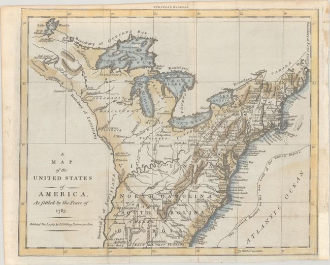
MapMaker: |
John Fielding
|
|
| |
| |
Subject: |
Eastern United States |
|
| |
Period/Size: |
1783 / 8.1" x 9.9" (20.6 x 25.2 cm)
|
|
| |
Color: |
Colored
|
|
| |
Condition: |
(B+) Issued folding, now flat, with light dampstaining at bottom and a binding trim and tiny associated tear at bottom right that have been repaired with old paper. Narrow margins at top and bottom, as issued. (condition help) |
|
| |
Source: |
European Magazine |
|
| |
References: |
Jolly #EUR-8; McCorkle #783.17; Sellers & van Ee #755. |
|
| |
|
|
| Sales Information |
| |
| |
Price: |
|
|
| |
| |
Offered by: |
Old World Auctions |
|
| |
Catalog: |
Auction No. 191 - Antique Maps, Charts, Atlases & Globes (9561) |
|
| |
Lot/Item #: |
164 |
|
| |
| |
Date: |
02/2023
|
|
| |
| |
|