Title:
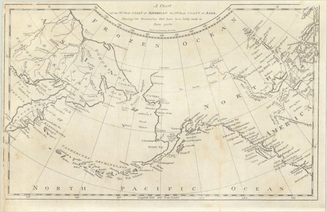
“A Chart of the Nth. West Coast of America, & the Nth. East Coast of Asia, Shewing the Discoveries That Have Been Lately Made in Those Parts”
Map Maker:
Morse/Gridley
This chart correctly shows the Alaskan peninsula w... (full text available to subscribers)
| Item Detail |
| |
| |
MapMaker: |
Morse/Gridley
|
|
| |
| |
Subject: |
North Pacific Ocean |
|
| |
Period/Size: |
1804 / 7.1" x 11.4" (18.1 x 29.0 cm)
|
|
| |
Color: |
Black & White
|
|
| |
Condition: |
(B+) Issued folding with light foxing. The lower left sheet edge has been backed with old paper to repair a few tiny edge chips with minor loss of border. (condition help) |
|
| |
Source: |
Morse's Geography |
|
| |
References: |
|
|
| |
|
|
| Sales Information |
| |
| |
Price: |
|
|
| |
| |
Offered by: |
Old World Auctions |
|
| |
Catalog: |
Auction No. 191 - Antique Maps, Charts, Atlases & Globes (9561) |
|
| |
Lot/Item #: |
768 |
|
| |
| |
Date: |
02/2023
|
|
| |
| |
|
Antique Maps - Valuation and Pricing, Descriptions, Resources |
|
Home |
Information |
Search |
Register |
Contact Us |
Site Map
Americana Exchange, Inc. © 1999 - 2024 Americana Exchange, Inc.. All rights reserved.
OldMaps.com, the OldMaps.com logo and
AMPR are service marks or registered service marks of Americana Exchange, Inc..
|