Title:
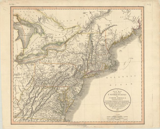
“A New Map of Part of the United States of North America, Containing Those of New York, Vermont, New Hampshire, Massachusets, Connecticut, Rhode Island. Pennsylvania, New Jersey, Delaware, Maryland and Virginia...”
Map Maker:
John Cary
This is a fine, early 19th century map of the stat... (full text available to subscribers)
| Item Detail |
| |
| |
MapMaker: |
John Cary
|
|
| |
| |
Subject: |
New England & Mid-Atlantic United States |
|
| |
Period/Size: |
1806 / 18.2" x 20.6" (46.3 x 52.4 cm)
|
|
| |
Color: |
Colored
|
|
| |
Condition: |
(B+) Contemporary outline color on "1804" watermarked paper. There are a few minor edge chips and tears at bottom, including two that enter the image about 2", that have been archivally repaired on verso. (condition help) |
|
| |
Source: |
New Universal Atlas |
|
| |
References: |
|
|
| |
|
|
| Sales Information |
| |
| |
Price: |
|
|
| |
| |
Offered by: |
Old World Auctions |
|
| |
Catalog: |
Auction No. 191 - Antique Maps, Charts, Atlases & Globes (9561) |
|
| |
Lot/Item #: |
180 |
|
| |
| |
Date: |
02/2023
|
|
| |
| |
|
Antique Maps - Valuation and Pricing, Descriptions, Resources |
|
Home |
Information |
Search |
Register |
Contact Us |
Site Map
Americana Exchange, Inc. © 1999 - 2024 Americana Exchange, Inc.. All rights reserved.
OldMaps.com, the OldMaps.com logo and
AMPR are service marks or registered service marks of Americana Exchange, Inc..
|