Title:
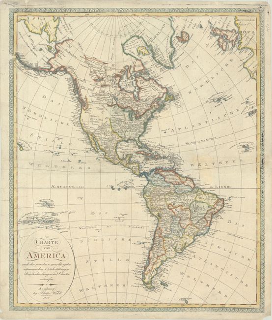
“Charte von America nach den Neuesten u. Zuverlassigsten Astronomischen Ortsbestinungen Reisebeschreibungen und Charter Entworfen”
Map Maker:
Johannes Walch
A large and attractive map of the Americas extendi... (full text available to subscribers)
| Item Detail |
| |
| |
MapMaker: |
Johannes Walch
|
|
| |
| |
Subject: |
Western Hemisphere - America |
|
| |
Period/Size: |
1818 / 24.1" x 20.4" (61.3 x 51.9 cm)
|
|
| |
Color: |
Colored
|
|
| |
Condition: |
(B+) There is a 1.25" x 2.25" section of the Atlantic Ocean that has been archivally replaced with the "EL" of "WELTMEER" drawn in facsimile. There is minor soiling and a few edge tears confined to the margins. (condition help) |
|
| |
Source: |
|
|
| |
References: |
|
|
| |
|
|
| Sales Information |
| |
| |
Price: |
|
|
| |
| |
Offered by: |
Old World Auctions |
|
| |
Catalog: |
Auction No. 191 - Antique Maps, Charts, Atlases & Globes (9561) |
|
| |
Lot/Item #: |
89 |
|
| |
| |
Date: |
02/2023
|
|
| |
| |
|
Antique Maps - Valuation and Pricing, Descriptions, Resources |
|
Home |
Information |
Search |
Register |
Contact Us |
Site Map
Americana Exchange, Inc. © 1999 - 2024 Americana Exchange, Inc.. All rights reserved.
OldMaps.com, the OldMaps.com logo and
AMPR are service marks or registered service marks of Americana Exchange, Inc..
|