Title:
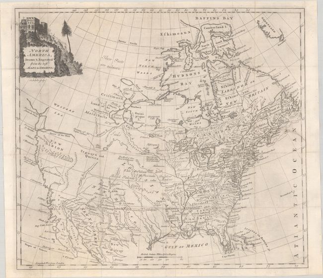
“North America, Drawn & Engraved from the Best Maps & Charts”
Map Maker:
Thomas Kitchin
This map was issued four years prior to the Revolu... (full text available to subscribers)
| Item Detail |
| |
| |
MapMaker: |
Thomas Kitchin
|
|
| |
| |
Subject: |
Colonial North America |
|
| |
Period/Size: |
1771 / 13.1" x 14.6" (33.3 x 37.1 cm)
|
|
| |
Color: |
Black & White
|
|
| |
Condition: |
(B+) Issued folding and now flat with an archivally repaired 3" edge tear at right. A binding trim at upper right has been skillfully replaced with old paper. (condition help) |
|
| |
Source: |
A New System of Geography... |
|
| |
References: |
McGuirk #126; McCorkle (18th C. Geography Books) #107-23. |
|
| |
|
|
| Sales Information |
| |
| |
Price: |
|
|
| |
| |
Offered by: |
Old World Auctions |
|
| |
Catalog: |
Auction No. 191 - Antique Maps, Charts, Atlases & Globes (9561) |
|
| |
Lot/Item #: |
98 |
|
| |
| |
Date: |
02/2023
|
|
| |
| |
|
Antique Maps - Valuation and Pricing, Descriptions, Resources |
|
Home |
Information |
Search |
Register |
Contact Us |
Site Map
Americana Exchange, Inc. © 1999 - 2024 Americana Exchange, Inc.. All rights reserved.
OldMaps.com, the OldMaps.com logo and
AMPR are service marks or registered service marks of Americana Exchange, Inc..
|