| Item Detail |
| |
| |
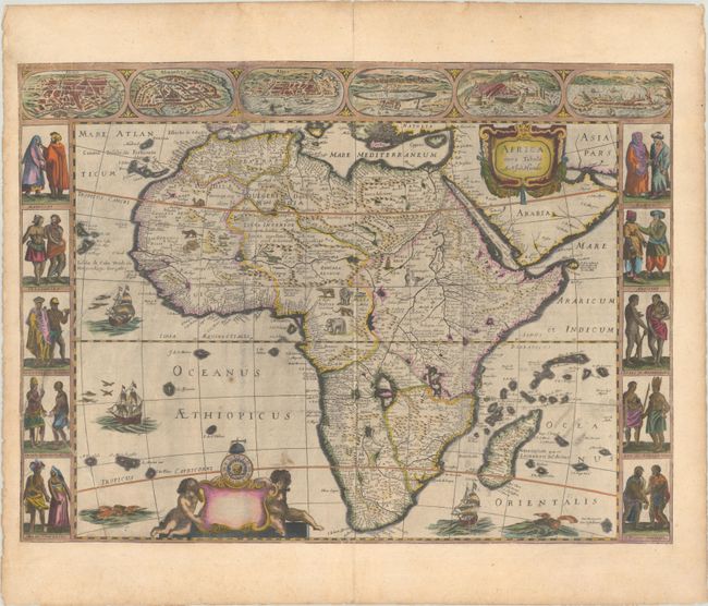
MapMaker: |
Nicolas Picart
|
|
| |
| |
Subject: |
Africa |
|
| |
Period/Size: |
1659 / 16.0" x 21.7" (40.7 x 55.2 cm)
|
|
| |
Color: |
Colored
|
|
| |
Condition: |
(B) A dark impression with light soiling and some printer's ink residue. The map was issued folding, and was subsequently flattened, trimmed to the neatlines, and pasted onto a sheet with Latin text on verso. Several tears have been repaired, including (condition help) |
|
| |
Source: |
|
|
| |
References: |
Betz #73.2. |
|
| |
|
|
| Sales Information |
| |
| |
Price: |
|
|
| |
| |
Offered by: |
Old World Auctions |
|
| |
Catalog: |
Auction No. 191 - Antique Maps, Charts, Atlases & Globes (9561) |
|
| |
Lot/Item #: |
727 |
|
| |
| |
Date: |
02/2023
|
|
| |
| |
|