| Item Detail |
| |
| |
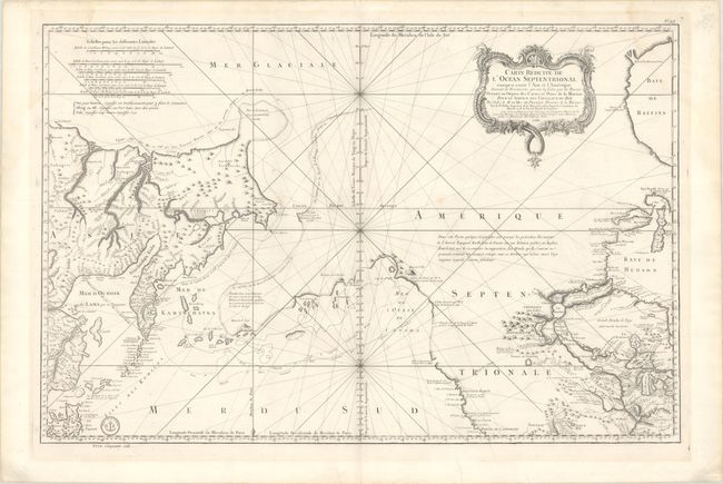
MapMaker: |
Jacques Nicolas Bellin
|
|
| |
| |
Subject: |
Western North America & North Pacific Ocean |
|
| |
Period/Size: |
1766 / 21.9" x 33.4" (55.7 x 84.9 cm)
|
|
| |
Color: |
Black & White
|
|
| |
Condition: |
(B+) On a bright sheet of watermarked paper with a hint of toning, a few minor spots, and a faint dampstain extending into the top right corner of the image. There is a short repaired edge tear confined to the bottom blank margin and some minor creasing (condition help) |
|
| |
Source: |
Hydrographie Francoise |
|
| |
References: |
Kershaw #1127; Wagner #610; Tooley (MCC-96) #771; Falk #1766-1; McGuirk #133. |
|
| |
|
|
| Sales Information |
| |
| |
Price: |
|
|
| |
| |
Offered by: |
Old World Auctions |
|
| |
Catalog: |
Auction No. 191 - Antique Maps, Charts, Atlases & Globes (9561) |
|
| |
Lot/Item #: |
108 |
|
| |
| |
Date: |
02/2023
|
|
| |
| |
|