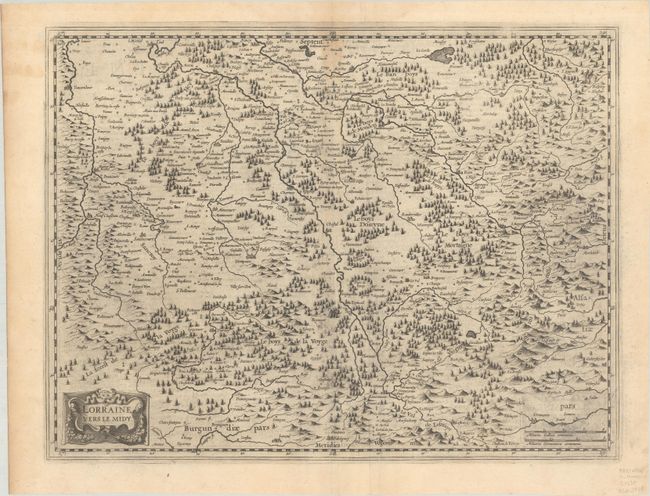
Title:
“Lorraine, Vers le Midy”
Map Maker:
Mercator/Hondius
This nicely engraved map of southern Lorraine iden... (full text available to subscribers)
| Item Detail |
| |
| |
MapMaker: |
Mercator/Hondius
|
|
| |
| |
Subject: |
Northeastern France |
|
| |
Period/Size: |
1633 / 14.8" x 19.5" (37.6 x 49.6 cm)
|
|
| |
Color: |
Black & White
|
|
| |
Condition: |
(B+) On a sheet with a coat of arms watermark. There is light dampstaining along the centerfold at top and light printer's ink residue. (condition help) |
|
| |
Source: |
Gerardi Mercatoris et I. Hondii - Atlas... |
|
| |
References: |
Van der Krogt (Vol. I) #4252:1B.1. |
|
| |
|
|
| Sales Information |
| |
| |
Price: |
|
|
| |
| |
Offered by: |
Old World Auctions |
|
| |
Catalog: |
Auction No. 192 - Antique Maps, Charts, Atlases & Globes (9562) |
|
| |
Lot/Item #: |
452 |
|
| |
| |
Date: |
04/2023
|
|
| |
| |
|
Antique Maps - Valuation and Pricing, Descriptions, Resources |
|
Home |
Information |
Search |
Register |
Contact Us |
Site Map
Americana Exchange, Inc. © 1999 - 2024 Americana Exchange, Inc.. All rights reserved.
OldMaps.com, the OldMaps.com logo and
AMPR are service marks or registered service marks of Americana Exchange, Inc..
|