| Item Detail |
| |
| |
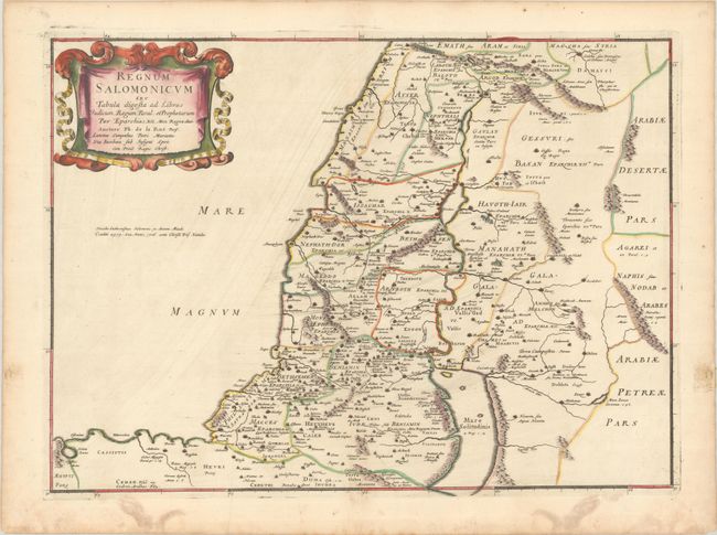
MapMaker: |
Philippe de la Rue
|
|
| |
| |
Subject: |
Holy Land |
|
| |
Period/Size: |
1651 / 15.5" x 21.2" (39.4 x 53.9 cm)
|
|
| |
Color: |
Colored
|
|
| |
Condition: |
(A) A dark impression with contemporary outline color in the map and later color in the cartouche, on a bright sheet with a large coat of arms watermark. There is light printer's ink residue, some damp stains confined to the blank margins, and an old pap (condition help) |
|
| |
Source: |
La Terre Sainte en Six Cartes Geographiquesģ |
|
| |
References: |
Laor #417; Pastoureau, LA RUE [3]. |
|
| |
|
|
| Sales Information |
| |
| |
Price: |
|
|
| |
| |
Offered by: |
Old World Auctions |
|
| |
Catalog: |
Auction No. 192 - Antique Maps, Charts, Atlases & Globes (9562) |
|
| |
Lot/Item #: |
583 |
|
| |
| |
Date: |
04/2023
|
|
| |
| |
|