| Item Detail |
| |
| |
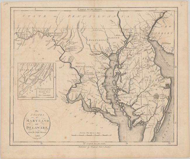
MapMaker: |
John Reid
|
|
| |
| |
Subject: |
Maryland & Delaware |
|
| |
Period/Size: |
1795 / 14.2" x 17.1" (36.1 x 43.5 cm)
|
|
| |
Color: |
Black & White
|
|
| |
Condition: |
(B+) There is light offsetting, a couple of minor stains, and an archivally repaired centerfold separation at bottom. (condition help) |
|
| |
Source: |
|
|
| |
References: |
Phillips (Atlases) #1216-13; Wheat & Brun #517. |
|
| |
|
|
| Sales Information |
| |
| |
Price: |
|
|
| |
| |
Offered by: |
Old World Auctions |
|
| |
Catalog: |
Auction No. 192 - Antique Maps, Charts, Atlases & Globes (9562) |
|
| |
Lot/Item #: |
185 |
|
| |
| |
Date: |
04/2023
|
|
| |
| |
|