Title:
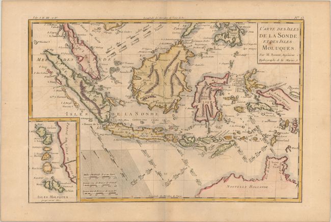
“Carte des Isles de la Sonde, et des Isles Moluques”
Map Maker:
Rigobert Bonne
Great little map focused on the islands of Java, S... (full text available to subscribers)
| Item Detail |
| |
| |
MapMaker: |
Rigobert Bonne
|
|
| |
| |
Subject: |
East Indies - Indonesia |
|
| |
Period/Size: |
1780 / 8.4" x 12.5" (21.4 x 31.8 cm)
|
|
| |
Color: |
Colored
|
|
| |
Condition: |
(B+) A crisp impression on a lightly toned sheet with a bunch of grapes watermark, minor offsetting and a few spots of foxing. (condition help) |
|
| |
Source: |
Atlas de Toutes les Parties Connues du Globe Terrestre |
|
| |
References: |
|
|
| |
|
|
| Sales Information |
| |
| |
Price: |
|
|
| |
| |
Offered by: |
Old World Auctions |
|
| |
Catalog: |
Auction No. 192 - Antique Maps, Charts, Atlases & Globes (9562) |
|
| |
Lot/Item #: |
637 |
|
| |
| |
Date: |
04/2023
|
|
| |
| |
|
Antique Maps - Valuation and Pricing, Descriptions, Resources |
|
Home |
Information |
Search |
Register |
Contact Us |
Site Map
Americana Exchange, Inc. © 1999 - 2024 Americana Exchange, Inc.. All rights reserved.
OldMaps.com, the OldMaps.com logo and
AMPR are service marks or registered service marks of Americana Exchange, Inc..
|