| Item Detail |
| |
| |
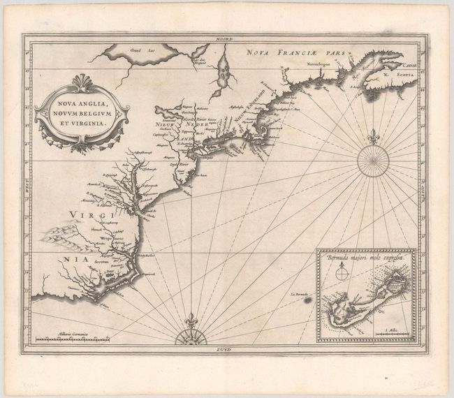
MapMaker: |
Hessel Gerritsz & Joannes de Laet
|
|
| |
| |
Subject: |
Colonial New England & Mid-Atlantic United States |
|
| |
Period/Size: |
1630 / 11.0" x 14.0" (28.0 x 35.6 cm)
|
|
| |
Color: |
Black & White
|
|
| |
Condition: |
(A) A crisp impression on paper with a coat of arms watermark. There is a small hole confined to the blank margin at top left. (condition help) |
|
| |
Source: |
Nieuwe Wereldt ofte Beschrijvinghe van West-Indien… |
|
| |
References: |
Augustyn & Cohen pp. 26-7; Burden #231; Cumming (SE) #35; McCorkle #630.1; Schwartz & Ehrenberg, pl. 57, p. 103. |
|
| |
|
|
| Sales Information |
| |
| |
Price: |
|
|
| |
| |
Offered by: |
Old World Auctions |
|
| |
Catalog: |
Auction No. 192 - Antique Maps, Charts, Atlases & Globes (9562) |
|
| |
Lot/Item #: |
169 |
|
| |
| |
Date: |
04/2023
|
|
| |
| |
|