| Item Detail |
| |
| |
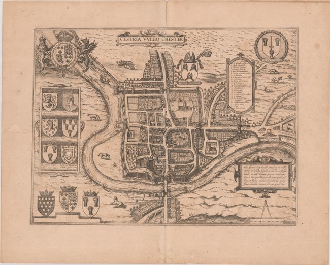
MapMaker: |
Johann Waesberger
|
|
| |
| |
Subject: |
Chester, England |
|
| |
Period/Size: |
1682 / 12.8" x 17.1" (32.6 x 43.5 cm)
|
|
| |
Color: |
Black & White
|
|
| |
Condition: |
(B+) On a lightly toned sheet with light offsetting, a minor horizontal extraneous crease, and a few tiny wormholes that are only visible when held up to light. There is a centerfold separation just entering the map border at top that has been closed on (condition help) |
|
| |
Source: |
Tooneel der Vermaarste Koop-Steden |
|
| |
References: |
Van der Krogt (Vol. IV) #874, st. 2. |
|
| |
|
|
| Sales Information |
| |
| |
Price: |
|
|
| |
| |
Offered by: |
Old World Auctions |
|
| |
Catalog: |
Auction No. 192 - Antique Maps, Charts, Atlases & Globes (9562) |
|
| |
Lot/Item #: |
409 |
|
| |
| |
Date: |
04/2023
|
|
| |
| |
|