| Item Detail |
| |
| |
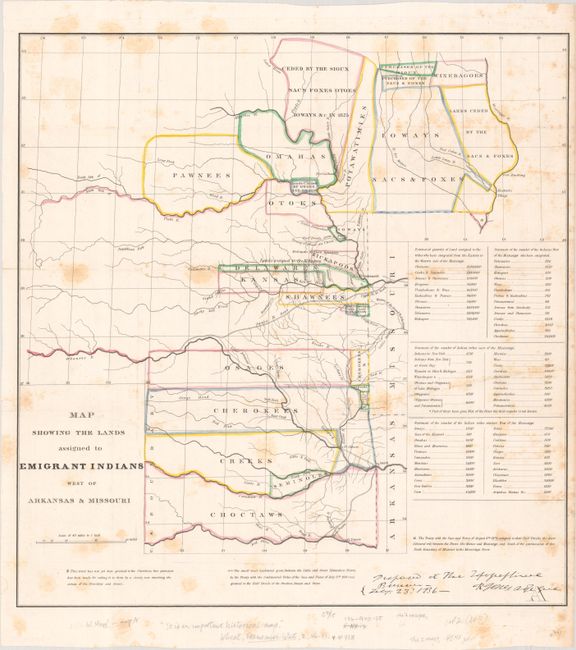
MapMaker: |
U.S. Gov.
|
|
| |
| |
Subject: |
Central United States |
|
| |
Period/Size: |
1836 / 18.7" x 18.0" (47.5 x 45.8 cm)
|
|
| |
Color: |
Colored
|
|
| |
Condition: |
(B) Issued folding with scattered foxing. There is an old stamp for the Concord Free Public Library on verso. (condition help) |
|
| |
Source: |
|
|
| |
References: |
Claussen & Friis #127; Wheat (TMW) #418; Wagner-Camp #63. |
|
| |
|
|
| Sales Information |
| |
| |
Price: |
|
|
| |
| |
Offered by: |
Old World Auctions |
|
| |
Catalog: |
Auction No. 192 - Antique Maps, Charts, Atlases & Globes (9562) |
|
| |
Lot/Item #: |
197 |
|
| |
| |
Date: |
04/2023
|
|
| |
| |
|