Title:
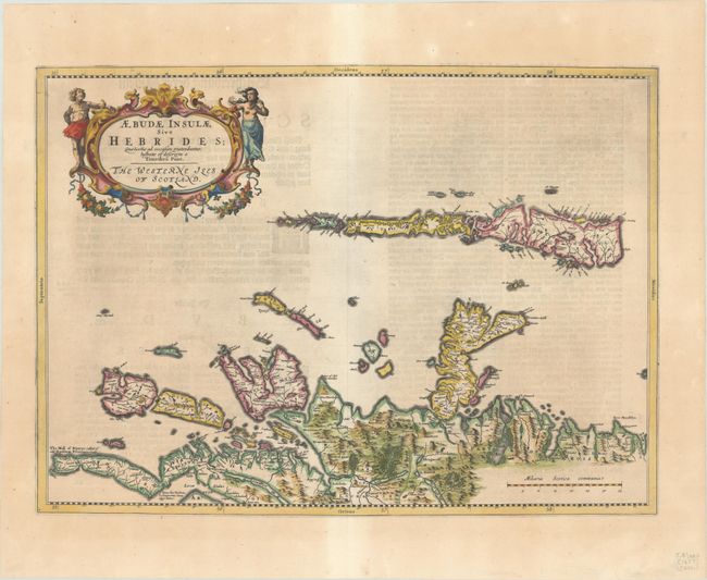
“Aebudae Insulae sive Hebrides; quae Scotiae ad Occasum Praetenduntur, Lustratae et Descriptae a Timotheo Pont. The Western Iles of Scotland”
Map Maker:
Johannes Blaeu
This handsome map of the Hebrides is oriented with... (full text available to subscribers)
| Item Detail |
| |
| |
MapMaker: |
Johannes Blaeu
|
|
| |
| |
Subject: |
Hebrides, Scotland |
|
| |
Period/Size: |
1654 / 15.1" x 20.9" (38.4 x 53.1 cm)
|
|
| |
Color: |
Colored
|
|
| |
Condition: |
(B+) A crisp impression with very light toning and some show-through of text on verso. (condition help) |
|
| |
Source: |
Novus Atlas ... Funfter Theil |
|
| |
References: |
Van der Krogt (Vol. II) #5860:2. |
|
| |
|
|
| Sales Information |
| |
| |
Price: |
|
|
| |
| |
Offered by: |
Old World Auctions |
|
| |
Catalog: |
Auction No. 192 - Antique Maps, Charts, Atlases & Globes (9562) |
|
| |
Lot/Item #: |
422 |
|
| |
| |
Date: |
04/2023
|
|
| |
| |
|
Antique Maps - Valuation and Pricing, Descriptions, Resources |
|
Home |
Information |
Search |
Register |
Contact Us |
Site Map
Americana Exchange, Inc. © 1999 - 2024 Americana Exchange, Inc.. All rights reserved.
OldMaps.com, the OldMaps.com logo and
AMPR are service marks or registered service marks of Americana Exchange, Inc..
|