Title:
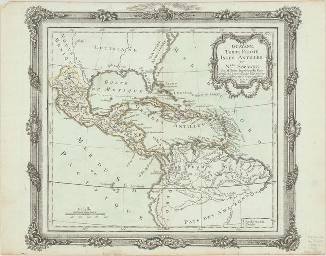
“Guayane, Terre Ferme, Isles Antilles, et Nlle. Espagne”
Map Maker:
Brion de la Tour/Desnos
Decorative map showing the southern part of North ... (full text available to subscribers)
| Item Detail |
| |
| |
MapMaker: |
Brion de la Tour/Desnos
|
|
| |
| |
Subject: |
Gulf of Mexico, Caribbean & Northern South America |
|
| |
Period/Size: |
1766 / 11.1" x 12.4" (28.2 x 31.5 cm)
|
|
| |
Color: |
Colored
|
|
| |
Condition: |
(B+) Contemporary outline color on bluish, watermarked paper with minor offsetting and light soiling along the edges of the sheet. Trimmed at top by the bookbinder with minor loss of the outer frame. (condition help) |
|
| |
Source: |
|
|
| |
References: |
|
|
| |
|
|
| Sales Information |
| |
| |
Price: |
|
|
| |
| |
Offered by: |
Old World Auctions |
|
| |
Catalog: |
Auction No. 192 - Antique Maps, Charts, Atlases & Globes (9562) |
|
| |
Lot/Item #: |
325 |
|
| |
| |
Date: |
04/2023
|
|
| |
| |
|
Antique Maps - Valuation and Pricing, Descriptions, Resources |
|
Home |
Information |
Search |
Register |
Contact Us |
Site Map
Americana Exchange, Inc. © 1999 - 2024 Americana Exchange, Inc.. All rights reserved.
OldMaps.com, the OldMaps.com logo and
AMPR are service marks or registered service marks of Americana Exchange, Inc..
|