Title:
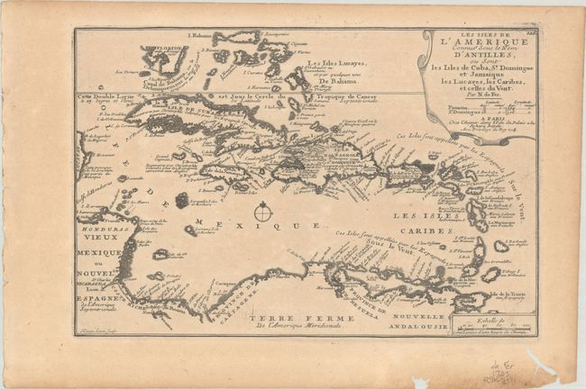
“Les Isles de l'Amerique Connues sous le Nom d'Antilles, ou sont les Isles de Cuba, St. Domingue et Jamaique les Lucayes, les Caribes, et Celles du Vent”
Map Maker:
Nicholas de Fer
There are a number of interesting historical and g... (full text available to subscribers)
| Item Detail |
| |
| |
MapMaker: |
Nicholas de Fer
|
|
| |
| |
Subject: |
Caribbean |
|
| |
Period/Size: |
1705 / 8.8" x 13.1" (22.4 x 33.3 cm)
|
|
| |
Color: |
Black & White
|
|
| |
Condition: |
(B+) A nice impression on a lightly toned sheet with a bunch of grapes watermark and two worm tracks in the bottom margin, not affecting the map. (condition help) |
|
| |
Source: |
Atlas Curieux |
|
| |
References: |
Pastoureau, FER I [112], fig. 67. |
|
| |
|
|
| Sales Information |
| |
| |
Price: |
|
|
| |
| |
Offered by: |
Old World Auctions |
|
| |
Catalog: |
Auction No. 192 - Antique Maps, Charts, Atlases & Globes (9562) |
|
| |
Lot/Item #: |
334 |
|
| |
| |
Date: |
04/2023
|
|
| |
| |
|
Antique Maps - Valuation and Pricing, Descriptions, Resources |
|
Home |
Information |
Search |
Register |
Contact Us |
Site Map
Americana Exchange, Inc. © 1999 - 2024 Americana Exchange, Inc.. All rights reserved.
OldMaps.com, the OldMaps.com logo and
AMPR are service marks or registered service marks of Americana Exchange, Inc..
|