| Item Detail |
| |
| |
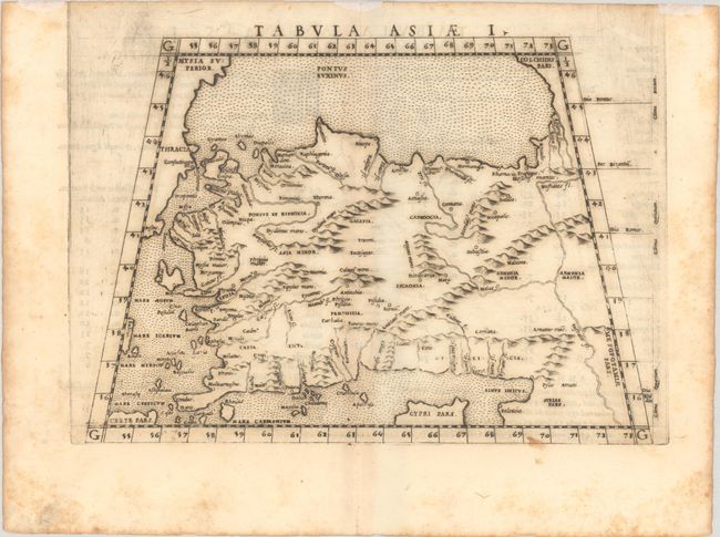
MapMaker: |
Ptolemy/Ruscelli
|
|
| |
| |
Subject: |
Turkey & Cyprus |
|
| |
Period/Size: |
1561 / 7.1" x 10.1" (18.1 x 25.7 cm)
|
|
| |
Color: |
Black & White
|
|
| |
Condition: |
(B) On watermarked paper with scattered foxing, light toning along the centerfold, and a short wormtrack in the image also along the centerfold. There are remnants of hinge tape in the top blank margin on recto. (condition help) |
|
| |
Source: |
La Geografia di Claudio Tolomeo Alessandrino… |
|
| |
References: |
Mickwitz & Miekkavaara #216-51; Shirley (BL Atlases) T.PTOL-10a. |
|
| |
|
|
| Sales Information |
| |
| |
Price: |
|
|
| |
| |
Offered by: |
Old World Auctions |
|
| |
Catalog: |
Auction No. 192 - Antique Maps, Charts, Atlases & Globes (9562) |
|
| |
Lot/Item #: |
574 |
|
| |
| |
Date: |
04/2023
|
|
| |
| |
|