| Item Detail |
| |
| |
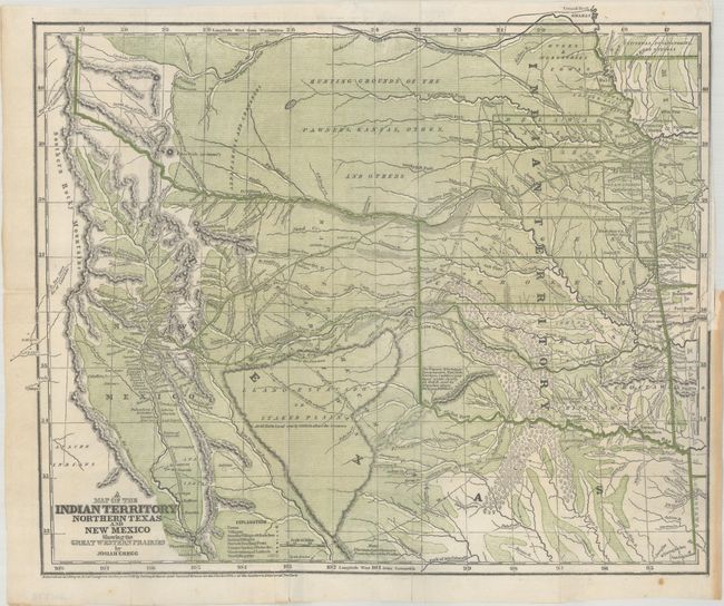
MapMaker: |
Josiah Gregg
|
|
| |
| |
Subject: |
South Central United States, Texas, Indian Territory |
|
| |
Period/Size: |
1844 / 12.7" x 15.5" (32.3 x 39.4 cm)
|
|
| |
Color: |
Colored
|
|
| |
Condition: |
(B) Issued folding and backed with tissue. There is a small repaired binding tear at right and several 1" - 3" fold separations that have been closed on verso with a combination of archival tape and paper tape. (condition help) |
|
| |
Source: |
Commerce of the Prairies |
|
| |
References: |
Wheat (TMW) #482; Wagner & Camp #108.1; Howes #G-401. |
|
| |
|
|
| Sales Information |
| |
| |
Price: |
|
|
| |
| |
Offered by: |
Old World Auctions |
|
| |
Catalog: |
Auction No. 192 - Antique Maps, Charts, Atlases & Globes (9562) |
|
| |
Lot/Item #: |
195 |
|
| |
| |
Date: |
04/2023
|
|
| |
| |
|