Title:
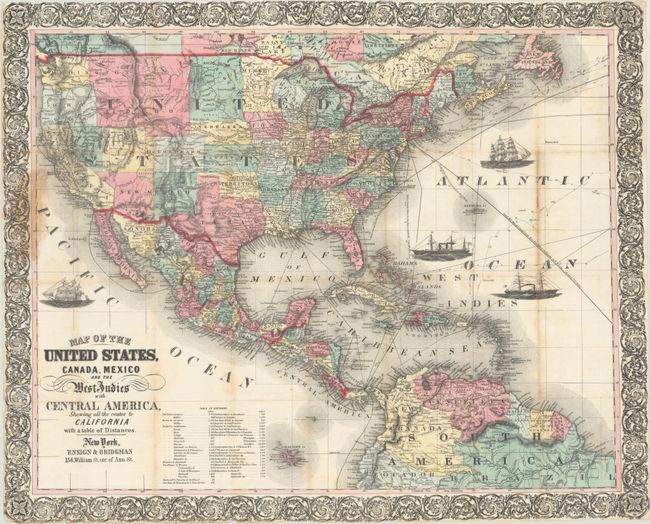
“Map of the United States, Canada, Mexico and the West Indies with Central America, Showing All the Routes to California with a Table of Distances”
Map Maker:
Ensign, Bridgman & Fanning
This is an updated Civil War era edition of Ensign... (full text available to subscribers)
| Item Detail |
| |
| |
MapMaker: |
Ensign, Bridgman & Fanning
|
|
| |
| |
Subject: |
North America, Civil War |
|
| |
Period/Size: |
1863 / 21.9" x 27.3" (55.7 x 69.4 cm)
|
|
| |
Color: |
Colored
|
|
| |
Condition: |
(B+) Issued folding with some light toning along the folds, staining along the left border where the map was previously attached to boards, and some small fold separations closed on verso with archival tape. Covers have minimal wear. (condition help) |
|
| |
Source: |
|
|
| |
References: |
cf. Wheat (TMW) #804. |
|
| |
|
|
| Sales Information |
| |
| |
Price: |
|
|
| |
| |
Offered by: |
Old World Auctions |
|
| |
Catalog: |
Auction No. 192 - Antique Maps, Charts, Atlases & Globes (9562) |
|
| |
Lot/Item #: |
99 |
|
| |
| |
Date: |
04/2023
|
|
| |
| |
|
Antique Maps - Valuation and Pricing, Descriptions, Resources |
|
Home |
Information |
Search |
Register |
Contact Us |
Site Map
Americana Exchange, Inc. © 1999 - 2024 Americana Exchange, Inc.. All rights reserved.
OldMaps.com, the OldMaps.com logo and
AMPR are service marks or registered service marks of Americana Exchange, Inc..
|