| Item Detail |
| |
| |
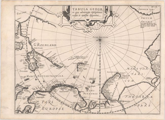
MapMaker: |
Johannes Isaksen Pontanus
|
|
| |
| |
Subject: |
North Pole |
|
| |
Period/Size: |
1611 / 10.5" x 14.0" (26.7 x 35.6 cm)
|
|
| |
Color: |
Black & White
|
|
| |
Condition: |
(A) Sharp impression on a bright sheet with the watermark of an armorial with a bend and crown. Issued folding and professionally backed in archival paper to repair some short, marginal tears. One light spot in map, else fine. (condition help) |
|
| |
Source: |
Rerum et Urbis Amstelodamensium Historia |
|
| |
References: |
Shirley (BL Atlases) G.PONT-1a #4. |
|
| |
|
|
| Sales Information |
| |
| |
Price: |
|
|
| |
| |
Offered by: |
Old World Auctions |
|
| |
Catalog: |
Auction No. 192 - Antique Maps, Charts, Atlases & Globes (9562) |
|
| |
Lot/Item #: |
48 |
|
| |
| |
Date: |
04/2023
|
|
| |
| |
|