| Item Detail |
| |
| |
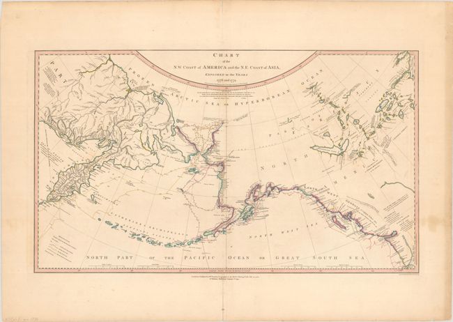
MapMaker: |
William Faden
|
|
| |
| |
Subject: |
North Pacific Ocean |
|
| |
Period/Size: |
1794 / 15.6" x 26.9" (39.7 x 68.4 cm)
|
|
| |
Color: |
Colored
|
|
| |
Condition: |
(B+) A crisp impression with contemporary outline color on a lightly toned sheet with light soiling, minor offsetting, moderate toning along the right edge of the sheet, and centerfold separations at top and bottom that have been closed on verso with arch (condition help) |
|
| |
Source: |
|
|
| |
References: |
Kershaw #1152; McGuirk #204. |
|
| |
|
|
| Sales Information |
| |
| |
Price: |
|
|
| |
| |
Offered by: |
Old World Auctions |
|
| |
Catalog: |
Auction No. 192 - Antique Maps, Charts, Atlases & Globes (9562) |
|
| |
Lot/Item #: |
686 |
|
| |
| |
Date: |
04/2023
|
|
| |
| |
|