| Item Detail |
| |
| |
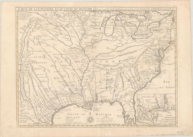
MapMaker: |
Delisle/Buache
|
|
| |
| |
Subject: |
Colonial Eastern United States, Louisiana Territory |
|
| |
Period/Size: |
1745 / 19.1" x 25.4" (48.6 x 64.6 cm)
|
|
| |
Color: |
Colored
|
|
| |
Condition: |
(A) A crisp impression on watermarked paper with somewhat faded contemporary outline color. There are a couple archivally repaired edge tears and light soiling that is mostly confined to the blank margins. (condition help) |
|
| |
Source: |
|
|
| |
References: |
Tooley (America) p.22, #46; cf. Cumming (SE) #208; cf. Wheat (TMW) #99; cf. Martin & Martin #19. |
|
| |
|
|
| Sales Information |
| |
| |
Price: |
|
|
| |
| |
Offered by: |
Old World Auctions |
|
| |
Catalog: |
Auction No. 190 - Antique Maps, Charts, Atlases & Globes (9560) |
|
| |
Lot/Item #: |
128 |
|
| |
| |
Date: |
11/2022
|
|
| |
| |
|