| Item Detail |
| |
| |
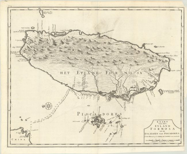
MapMaker: |
Francois Valentyn
|
|
| |
| |
Subject: |
Taiwan |
|
| |
Period/Size: |
1726 / 17.4" x 22.0" (44.2 x 55.9 cm)
|
|
| |
Color: |
Black & White
|
|
| |
Condition: |
(B+) A dark impression issued folding on a bright sheet with a Strasburg Bend & Lily watermark. There is minor offsetting, some some printer's ink residue at top and a chip at top right, not affecting the image. There is a binding trim in the right blan (condition help) |
|
| |
Source: |
Oud en Nieuw Oost-Indien... |
|
| |
References: |
Shirley (BL Atlases) G.VALN-1a #43. |
|
| |
|
|
| Sales Information |
| |
| |
Price: |
|
|
| |
| |
Offered by: |
Old World Auctions |
|
| |
Catalog: |
Auction No. 190 - Antique Maps, Charts, Atlases & Globes (9560) |
|
| |
Lot/Item #: |
594 |
|
| |
| |
Date: |
11/2022
|
|
| |
| |
|