| Item Detail |
| |
| |
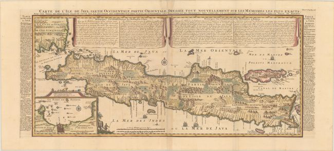
MapMaker: |
Henry Abraham Chatelain
|
|
| |
| |
Subject: |
Java, Indonesia |
|
| |
Period/Size: |
1719 / 15.0" x 34.3" (38.1 x 87.2 cm)
|
|
| |
Color: |
Colored
|
|
| |
Condition: |
(B+) A dark impression and wide original margins on sheets with a Strasburg bend and lily watermark, a couple of printer's creases, and light toning along the centerfold. (condition help) |
|
| |
Source: |
Atlas Historique |
|
| |
References: |
Parry, p. 197. |
|
| |
|
|
| Sales Information |
| |
| |
Price: |
|
|
| |
| |
Offered by: |
Old World Auctions |
|
| |
Catalog: |
Auction No. 190 - Antique Maps, Charts, Atlases & Globes (9560) |
|
| |
Lot/Item #: |
613 |
|
| |
| |
Date: |
11/2022
|
|
| |
| |
|