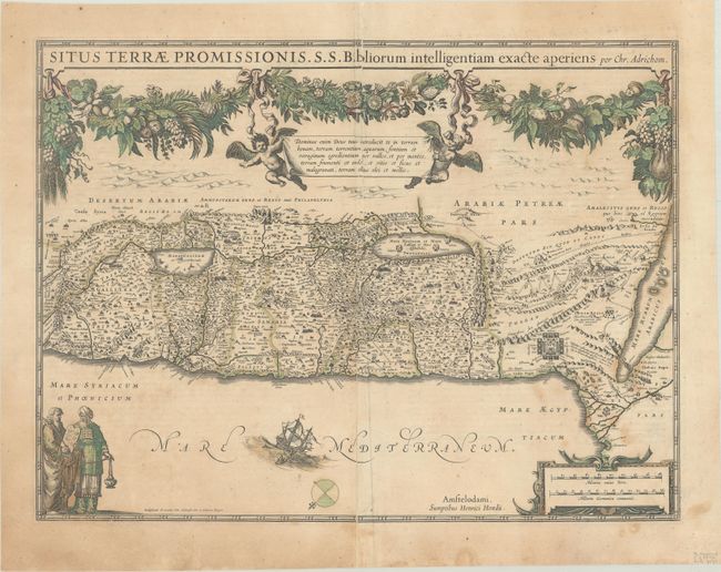
Title:
“Situs Terrae Promissionis. S.S. Bibliorum Intelligentiam Exacte Aperiens per Chr. Adrichom”
Map Maker:
Henricus Hondius
Superb map of the Holy Land based on the cartograp... (full text available to subscribers)
| Item Detail |
| |
| |
MapMaker: |
Henricus Hondius
|
|
| |
| |
Subject: |
Holy Land |
|
| |
Period/Size: |
1633 / 14.6" x 19.6" (37.1 x 49.8 cm)
|
|
| |
Color: |
Colored
|
|
| |
Condition: |
(B) Full contemporary color with scattered stains and archival repairs to some short cracks and to separations along the centerfold. (condition help) |
|
| |
Source: |
|
|
| |
References: |
Laor #23; Van der Krogt (Vol. I) #8150:1C.1. |
|
| |
|
|
| Sales Information |
| |
| |
Price: |
|
|
| |
| |
Offered by: |
Old World Auctions |
|
| |
Catalog: |
Auction No. 190 - Antique Maps, Charts, Atlases & Globes (9560) |
|
| |
Lot/Item #: |
551 |
|
| |
| |
Date: |
11/2022
|
|
| |
| |
|
Antique Maps - Valuation and Pricing, Descriptions, Resources |
|
Home |
Information |
Search |
Register |
Contact Us |
Site Map
Americana Exchange, Inc. © 1999 - 2024 Americana Exchange, Inc.. All rights reserved.
OldMaps.com, the OldMaps.com logo and
AMPR are service marks or registered service marks of Americana Exchange, Inc..
|