Title:
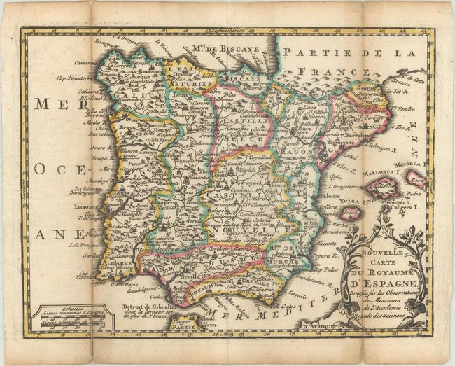
“Nouvelle Carte du Royaume d'Espagne, Dressee sur les Observations de Messieurs de l'Academie Royale des Sciences”
Map Maker:
Hendrik de Leth
This small map of the Iberian Peninsula is filled ... (full text available to subscribers)
| Item Detail |
| |
| |
MapMaker: |
Hendrik de Leth
|
|
| |
| |
Subject: |
Spain & Portugal |
|
| |
Period/Size: |
1740 / 6.5" x 8.5" (16.6 x 21.6 cm)
|
|
| |
Color: |
Colored
|
|
| |
Condition: |
(B+) A dark impression with contemporary outline color, issued folding with light toning along the folds and short fold separations that have been archivally repaired on verso. (condition help) |
|
| |
Source: |
Nouvel Atlas Geographique & Historique... |
|
| |
References: |
Shirley (BL Atlases) T.LETH-1a. |
|
| |
|
|
| Sales Information |
| |
| |
Price: |
|
|
| |
| |
Offered by: |
Old World Auctions |
|
| |
Catalog: |
Auction No. 190 - Antique Maps, Charts, Atlases & Globes (9560) |
|
| |
Lot/Item #: |
428 |
|
| |
| |
Date: |
11/2022
|
|
| |
| |
|
Antique Maps - Valuation and Pricing, Descriptions, Resources |
|
Home |
Information |
Search |
Register |
Contact Us |
Site Map
Americana Exchange, Inc. © 1999 - 2024 Americana Exchange, Inc.. All rights reserved.
OldMaps.com, the OldMaps.com logo and
AMPR are service marks or registered service marks of Americana Exchange, Inc..
|