Title:
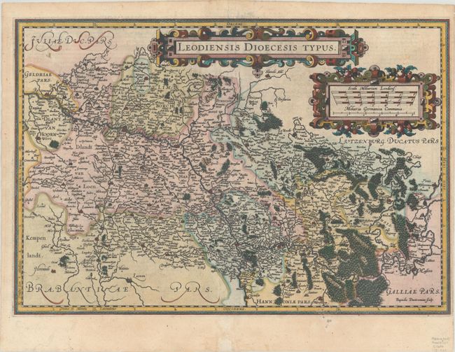
“Leodiensis Dioecesis Typus”
Map Maker:
Mercator/Hondius
This handsome, boldly engraved map of the Muese Ri... (full text available to subscribers)
| Item Detail |
| |
| |
MapMaker: |
Mercator/Hondius
|
|
| |
| |
Subject: |
Eastern Belgium |
|
| |
Period/Size: |
1606 / 13.0" x 19.2" (33.1 x 48.8 cm)
|
|
| |
Color: |
Colored
|
|
| |
Condition: |
(A) A dark impression with a couple of tiny spots in the bottom border and an archivally repaired chip at bottom center. Narrow (but adequate) right margin, apparently as issued. (condition help) |
|
| |
Source: |
Gerardi Mercatoris - Atlas sive Cosmographicae |
|
| |
References: |
Van der Krogt (Vol. I) #3360:1A. |
|
| |
|
|
| Sales Information |
| |
| |
Price: |
|
|
| |
| |
Offered by: |
Old World Auctions |
|
| |
Catalog: |
Auction No. 190 - Antique Maps, Charts, Atlases & Globes (9560) |
|
| |
Lot/Item #: |
393 |
|
| |
| |
Date: |
11/2022
|
|
| |
| |
|
Antique Maps - Valuation and Pricing, Descriptions, Resources |
|
Home |
Information |
Search |
Register |
Contact Us |
Site Map
Americana Exchange, Inc. © 1999 - 2024 Americana Exchange, Inc.. All rights reserved.
OldMaps.com, the OldMaps.com logo and
AMPR are service marks or registered service marks of Americana Exchange, Inc..
|