Title:
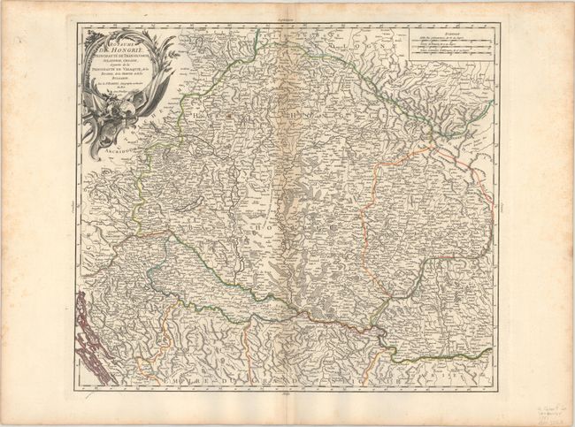
“Royaume de Hongrie, Principaute de Transilvanie, Sclavonie, Croatie, et Partie de la Principaute de Valaquie, de la Bosnie, de la Servie et de la Bulgarie”
Map Maker:
Gilles Robert de Vaugondy
This is Robert de Vaugondy's detailed map covering... (full text available to subscribers)
| Item Detail |
| |
| |
MapMaker: |
Gilles Robert de Vaugondy
|
|
| |
| |
Subject: |
Southeastern Europe, Hungary |
|
| |
Period/Size: |
1751 / 18.8" x 21.6" (47.8 x 54.9 cm)
|
|
| |
Color: |
Colored
|
|
| |
Condition: |
(B+) A crisp impression on a watermarked sheet with light toning along the centerfold and a couple small rust spots. There is light scattered foxing along the sheet's edges, well away from map image. (condition help) |
|
| |
Source: |
Atlas Universel |
|
| |
References: |
Pedley #288. |
|
| |
|
|
| Sales Information |
| |
| |
Price: |
|
|
| |
| |
Offered by: |
Old World Auctions |
|
| |
Catalog: |
Auction No. 190 - Antique Maps, Charts, Atlases & Globes (9560) |
|
| |
Lot/Item #: |
496 |
|
| |
| |
Date: |
11/2022
|
|
| |
| |
|
Antique Maps - Valuation and Pricing, Descriptions, Resources |
|
Home |
Information |
Search |
Register |
Contact Us |
Site Map
Americana Exchange, Inc. © 1999 - 2024 Americana Exchange, Inc.. All rights reserved.
OldMaps.com, the OldMaps.com logo and
AMPR are service marks or registered service marks of Americana Exchange, Inc..
|