| Item Detail |
| |
| |
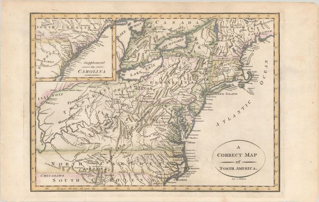
MapMaker: |
(none given)
|
|
| |
| |
Subject: |
New England & Mid-Atlantic United States |
|
| |
Period/Size: |
1800 / 8.3" x 11.6" (21.1 x 29.5 cm)
|
|
| |
Color: |
Colored
|
|
| |
Condition: |
(A) A nice impression on a sheet with a watermark with "1797" date. There are a few short edge tears that have been closed with archival tape in the left blank margin. (condition help) |
|
| |
Source: |
A New Historical and Commercial System of Geography |
|
| |
References: |
McCorkle #800.2. |
|
| |
|
|
| Sales Information |
| |
| |
Price: |
|
|
| |
| |
Offered by: |
Old World Auctions |
|
| |
Catalog: |
Auction No. 190 - Antique Maps, Charts, Atlases & Globes (9560) |
|
| |
Lot/Item #: |
139 |
|
| |
| |
Date: |
11/2022
|
|
| |
| |
|