Title:
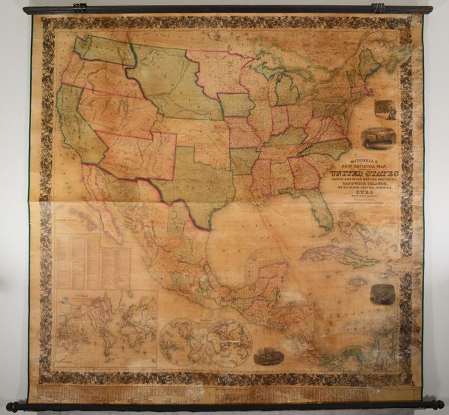
“Mitchell's New National Map, Exhibiting the United States with the North American British Provinces, Sandwich Islands, Mexico and Central America, Together with Cuba and Other West India Islands”
Map Maker:
Samuel Augustus Mitchell
This is the first edition of Mitchell's epi... (full text available to subscribers)
| Item Detail |
| |
| |
MapMaker: |
Samuel Augustus Mitchell
|
|
| |
| |
Subject: |
North America |
|
| |
Period/Size: |
1856 / 58.8" x 61.0" (149.4 x 155.0 cm)
|
|
| |
Color: |
Colored
|
|
| |
Condition: |
(B) Professionally conserved with new linen-backing and ribbon edging; original rollers are present and intact. There is moderate dampstaining and mildew spots along the right edge, with chips along the border at top right and bottom right replaced in fa (condition help) |
|
| |
Source: |
|
|
| |
References: |
Wheat (TMW) #896; Rumsey #2292. |
|
| |
|
|
| Sales Information |
| |
| |
Price: |
|
|
| |
| |
Offered by: |
Old World Auctions |
|
| |
Catalog: |
Auction No. 190 - Antique Maps, Charts, Atlases & Globes (9560) |
|
| |
Lot/Item #: |
80 |
|
| |
| |
Date: |
11/2022
|
|
| |
| |
|
Antique Maps - Valuation and Pricing, Descriptions, Resources |
|
Home |
Information |
Search |
Register |
Contact Us |
Site Map
Americana Exchange, Inc. © 1999 - 2024 Americana Exchange, Inc.. All rights reserved.
OldMaps.com, the OldMaps.com logo and
AMPR are service marks or registered service marks of Americana Exchange, Inc..
|