| Item Detail |
| |
| |
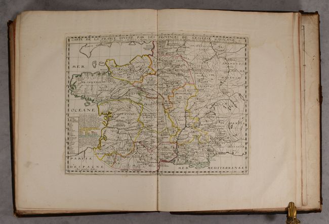
MapMaker: |
N. Sanson/Mariette
|
|
| |
| |
Subject: |
France & Belgium, Atlases |
|
| |
Period/Size: |
1707 / 21.3" x 16.4" (54.1 x 41.7 cm)
|
|
| |
Color: |
Colored
|
|
| |
Condition: |
(B+) The maps have contemporary outline color and range in condition from near fine (A) to good (B), with the majority in very good (B+) condition. There are dampstains at top affecting much of the volume, entering the engraved image on some of the maps. (condition help) |
|
| |
Source: |
|
|
| |
References: |
cf. Pastoureau, SANSON VI. |
|
| |
|
|
| Sales Information |
| |
| |
Price: |
|
|
| |
| |
Offered by: |
Old World Auctions |
|
| |
Catalog: |
Auction No. 190 - Antique Maps, Charts, Atlases & Globes (9560) |
|
| |
Lot/Item #: |
407 |
|
| |
| |
Date: |
11/2022
|
|
| |
| |
|