| Item Detail |
| |
| |
MapMaker: |
(none given)
|
|
| |
| |
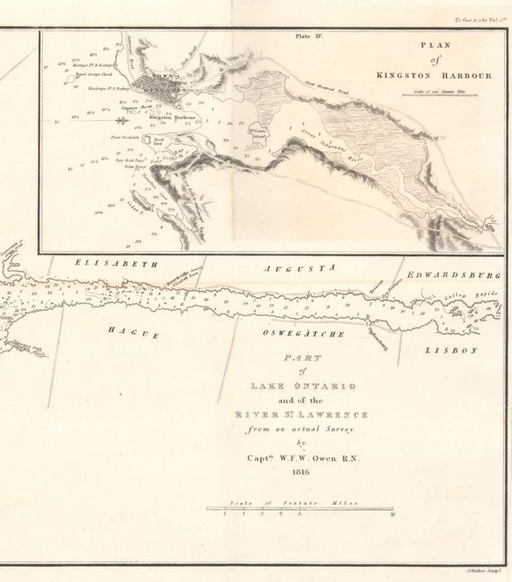
Subject: |
Lake Ontario & St. Lawrence River |
|
| |
Period/Size: |
1816 / 9.5" x 23.6" (24.2 x 60.0 cm)
|
|
| |
Color: |
Black & White
|
|
| |
Condition: |
(B+) Issued folding on a clean bright sheet with a small binding trim at lower right and associated tiny binding tear. There is faint offsetting and a bit of light toning at top right. (condition help) |
|
| |
Source: |
A Full and Correct Account of the Military Occurrences of the Late War... |
|
| |
References: |
Phillips (Maps) p. 639. |
|
| |
|
|
| Sales Information |
| |
| |
Price: |
|
|
| |
| |
Offered by: |
Old World Auctions |
|
| |
Catalog: |
Auction No. 190 - Antique Maps, Charts, Atlases & Globes (9560) |
|
| |
Lot/Item #: |
113 |
|
| |
| |
Date: |
11/2022
|
|
| |
| |
|