Title:
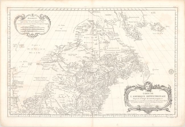
“Carte de l'Amerique Septentrionale Depuis le 28 Degre de Latitude Jusqu'au 72”
Map Maker:
Jacques Nicolas Bellin
Detailed large chart that covers nearly all of Nor... (full text available to subscribers)
| Item Detail |
| |
| |
MapMaker: |
Jacques Nicolas Bellin
|
|
| |
| |
Subject: |
Colonial United States & Canada |
|
| |
Period/Size: |
1755 / 22.0" x 33.9" (55.9 x 86.1 cm)
|
|
| |
Color: |
Black & White
|
|
| |
Condition: |
(B+) A crisp impression on a bright sheet with light soiling and an archivally repaired centerfold separation at bottom. (condition help) |
|
| |
Source: |
|
|
| |
References: |
McGuirk #46; Tooley (MCC-96) #762. |
|
| |
|
|
| Sales Information |
| |
| |
Price: |
|
|
| |
| |
Offered by: |
Old World Auctions |
|
| |
Catalog: |
Auction No. 190 - Antique Maps, Charts, Atlases & Globes (9560) |
|
| |
Lot/Item #: |
97 |
|
| |
| |
Date: |
11/2022
|
|
| |
| |
|
Antique Maps - Valuation and Pricing, Descriptions, Resources |
|
Home |
Information |
Search |
Register |
Contact Us |
Site Map
Americana Exchange, Inc. © 1999 - 2024 Americana Exchange, Inc.. All rights reserved.
OldMaps.com, the OldMaps.com logo and
AMPR are service marks or registered service marks of Americana Exchange, Inc..
|