Title:
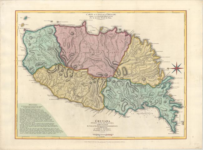
“Grenada Divided into its Parishes, Surveyed by Order of His Excellency Governor Scott / Carte de l'Isle de la Grenade Cedee a la Grande Bretagne par le Dernier Traite de Paix”
Map Maker:
Jefferys/Sayer
Handsome and hard to find map of the island shows ... (full text available to subscribers)
| Item Detail |
| |
| |
MapMaker: |
Jefferys/Sayer
|
|
| |
| |
Subject: |
Grenada |
|
| |
Period/Size: |
1775 / 18.4" x 24.5" (46.8 x 62.3 cm)
|
|
| |
Color: |
Colored
|
|
| |
Condition: |
(B+) A nice impression on a bright sheet with a large Strasburg Lily watermark. There are professional repairs to some short tears and a couple of small holes at bottom center that extend into the title at bottom. There are two short marginal tears that (condition help) |
|
| |
Source: |
West-India Atlas |
|
| |
References: |
Shirley (BL Atlases) M.JEF-4a #36; Tooley (MCC-62) #25. |
|
| |
|
|
| Sales Information |
| |
| |
Price: |
|
|
| |
| |
Offered by: |
Old World Auctions |
|
| |
Catalog: |
Auction No. 190 - Antique Maps, Charts, Atlases & Globes (9560) |
|
| |
Lot/Item #: |
293 |
|
| |
| |
Date: |
11/2022
|
|
| |
| |
|
Antique Maps - Valuation and Pricing, Descriptions, Resources |
|
Home |
Information |
Search |
Register |
Contact Us |
Site Map
Americana Exchange, Inc. © 1999 - 2024 Americana Exchange, Inc.. All rights reserved.
OldMaps.com, the OldMaps.com logo and
AMPR are service marks or registered service marks of Americana Exchange, Inc..
|