Title:
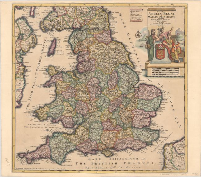
“Accuratissima Angliae Regni et Walliae Principatus Descriptio Distincte Divisa in Omnes suas Provincias et Editia”
Map Maker:
Cornelius Danckerts
Cornelis Danckerts, son of Justus Danckerts, made ... (full text available to subscribers)
| Item Detail |
| |
| |
MapMaker: |
Cornelius Danckerts
|
|
| |
| |
Subject: |
England & Wales |
|
| |
Period/Size: |
1696 / 20.2" x 20.9" (51.3 x 53.1 cm)
|
|
| |
Color: |
Colored
|
|
| |
Condition: |
(B+) A nice impression on a slightly toned sheet that has been professionally remargined on all four sides, with part of the border replaced in facsimile at top and bottom. There are archival repairs to a centerfold separation and edge tear at bottom. (condition help) |
|
| |
Source: |
|
|
| |
References: |
Shirley (BI to 1750) Danckerts #3. |
|
| |
|
|
| Sales Information |
| |
| |
Price: |
|
|
| |
| |
Offered by: |
Old World Auctions |
|
| |
Catalog: |
Auction No. 190 - Antique Maps, Charts, Atlases & Globes (9560) |
|
| |
Lot/Item #: |
357 |
|
| |
| |
Date: |
11/2022
|
|
| |
| |
|
Antique Maps - Valuation and Pricing, Descriptions, Resources |
|
Home |
Information |
Search |
Register |
Contact Us |
Site Map
Americana Exchange, Inc. © 1999 - 2024 Americana Exchange, Inc.. All rights reserved.
OldMaps.com, the OldMaps.com logo and
AMPR are service marks or registered service marks of Americana Exchange, Inc..
|