Title:
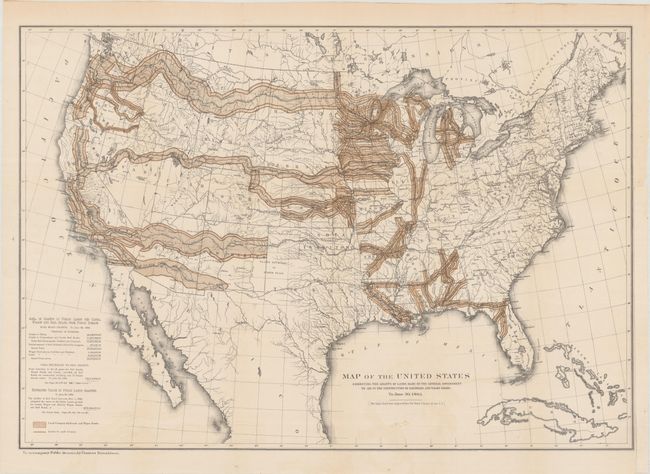
“Map of the United States Exhibiting the Grants of Lands Made by the General Government to Aid in the Construction of Railroads and Wagon Roads...”
Map Maker:
Thomas Donaldson
This map was originally produced by the U.S. Geolo... (full text available to subscribers)
| Item Detail |
| |
| |
MapMaker: |
Thomas Donaldson
|
|
| |
| |
Subject: |
United States |
|
| |
Period/Size: |
1883 / 19.8" x 28.5" (50.3 x 72.4 cm)
|
|
| |
Color: |
Colored
|
|
| |
Condition: |
(A) Issued folding with a hint of color offsetting at bottom. A binding trim at right has been replaced with old paper. (condition help) |
|
| |
Source: |
Public Domain |
|
| |
References: |
|
|
| |
|
|
| Sales Information |
| |
| |
Price: |
|
|
| |
| |
Offered by: |
Old World Auctions |
|
| |
Catalog: |
Auction No. 190 - Antique Maps, Charts, Atlases & Globes (9560) |
|
| |
Lot/Item #: |
120 |
|
| |
| |
Date: |
11/2022
|
|
| |
| |
|
Antique Maps - Valuation and Pricing, Descriptions, Resources |
|
Home |
Information |
Search |
Register |
Contact Us |
Site Map
Americana Exchange, Inc. © 1999 - 2024 Americana Exchange, Inc.. All rights reserved.
OldMaps.com, the OldMaps.com logo and
AMPR are service marks or registered service marks of Americana Exchange, Inc..
|