Title:
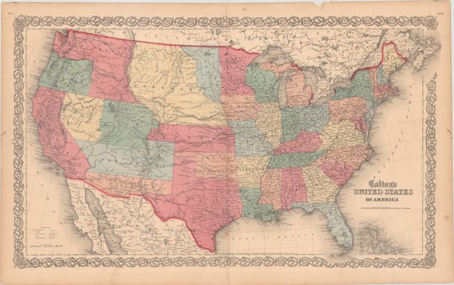
“Colton's United States of America”
Map Maker:
Johnson & Browning
This is a scarce map of the United States from the... (full text available to subscribers)
| Item Detail |
| |
| |
MapMaker: |
Johnson & Browning
|
|
| |
| |
Subject: |
United States |
|
| |
Period/Size: |
1859 / 15.6" x 26.5" (39.7 x 67.4 cm)
|
|
| |
Color: |
Colored
|
|
| |
Condition: |
(A) Attractive hand coloring with one faint spot along the lower centerfold. Short centerfold separations confined to the top and bottom blank margins have been closed on verso with archival tape. (condition help) |
|
| |
Source: |
Atlas of the World |
|
| |
References: |
|
|
| |
|
|
| Sales Information |
| |
| |
Price: |
|
|
| |
| |
Offered by: |
Old World Auctions |
|
| |
Catalog: |
Auction No. 190 - Antique Maps, Charts, Atlases & Globes (9560) |
|
| |
Lot/Item #: |
118 |
|
| |
| |
Date: |
11/2022
|
|
| |
| |
|
Antique Maps - Valuation and Pricing, Descriptions, Resources |
|
Home |
Information |
Search |
Register |
Contact Us |
Site Map
Americana Exchange, Inc. © 1999 - 2024 Americana Exchange, Inc.. All rights reserved.
OldMaps.com, the OldMaps.com logo and
AMPR are service marks or registered service marks of Americana Exchange, Inc..
|