Title:
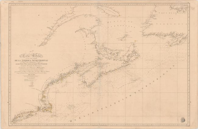
“N. 2. Carta Esferica de las Costas Orientales de la America Setentrional qu Comprehende Desde Nueva York Hasta el Golfo y Rio St. Lorenzo...”
Map Maker:
Direccion de Hidrografia
This incredibly detailed Spanish chart extends fro... (full text available to subscribers)
| Item Detail |
| |
| |
MapMaker: |
Direccion de Hidrografia
|
|
| |
| |
Subject: |
Northeastern United States & Canada |
|
| |
Period/Size: |
1828 / 24.8" x 36.4" (63.0 x 92.5 cm)
|
|
| |
Color: |
Colored
|
|
| |
Condition: |
(B+) On a sturdy sheet with light toning and minor offsetting. A faint dampstain runs along the bottom sheet edge. (condition help) |
|
| |
Source: |
|
|
| |
References: |
|
|
| |
|
|
| Sales Information |
| |
| |
Price: |
|
|
| |
| |
Offered by: |
Old World Auctions |
|
| |
Catalog: |
Auction No. 190 - Antique Maps, Charts, Atlases & Globes (9560) |
|
| |
Lot/Item #: |
109 |
|
| |
| |
Date: |
11/2022
|
|
| |
| |
|
Antique Maps - Valuation and Pricing, Descriptions, Resources |
|
Home |
Information |
Search |
Register |
Contact Us |
Site Map
Americana Exchange, Inc. © 1999 - 2024 Americana Exchange, Inc.. All rights reserved.
OldMaps.com, the OldMaps.com logo and
AMPR are service marks or registered service marks of Americana Exchange, Inc..
|