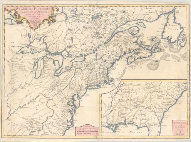
Title:
“Carte des Possessions Francoises et Angloises dans le Canada, et Partie de la Louisiane”
Map Maker:
Sieur S. G. Longchamp
This is the first state of this separately publish... (full text available to subscribers)
| Item Detail |
| |
| |
MapMaker: |
Sieur S. G. Longchamp
|
|
| |
| |
Subject: |
Colonial Eastern United States & Canada |
|
| |
Period/Size: |
1756 / 21.5" x 30.1" (54.7 x 76.5 cm)
|
|
| |
Color: |
Colored
|
|
| |
Condition: |
(B) Issued folding on a sheet with the watermark of a Maltese cross encircled in rosary beads. Two long and narrow strips at left (14") and right (10") were cleanly cut (likely by the binder) and reattached with archival materials. Fold separations alon (condition help) |
|
| |
Source: |
|
|
| |
References: |
Kershaw #358; McCorkle #756.9; Sellers & Van Ee #70. |
|
| |
|
|
| Sales Information |
| |
| |
Price: |
|
|
| |
| |
Offered by: |
Old World Auctions |
|
| |
Catalog: |
Auction No. 190 - Antique Maps, Charts, Atlases & Globes (9560) |
|
| |
Lot/Item #: |
100 |
|
| |
| |
Date: |
11/2022
|
|
| |
| |
|
Antique Maps - Valuation and Pricing, Descriptions, Resources |
|
Home |
Information |
Search |
Register |
Contact Us |
Site Map
Americana Exchange, Inc. © 1999 - 2024 Americana Exchange, Inc.. All rights reserved.
OldMaps.com, the OldMaps.com logo and
AMPR are service marks or registered service marks of Americana Exchange, Inc..
|