Title:
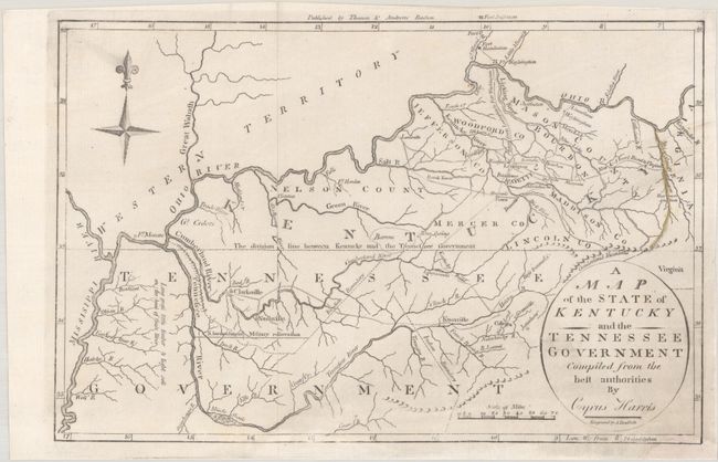
“A Map of the State of Kentucky and the Tennessee Government Compiled from the Best Authorities by Cyprus Harris”
Map Maker:
Rev. Jedidiah Morse
This very early map shows some topographical featu... (full text available to subscribers)
| Item Detail |
| |
| |
MapMaker: |
Rev. Jedidiah Morse
|
|
| |
| |
Subject: |
Kentucky & Tennessee |
|
| |
Period/Size: |
1796 / 7.6" x 11.5" (19.3 x 29.3 cm)
|
|
| |
Color: |
Black & White
|
|
| |
Condition: |
(B+) Issued folding and now flat on a clean bright sheet with the Big Sandy River colored in yellow. There is a small chip in the bottom right corner of the sheet that has been professionally replaced with border drawn in facsimile. (condition help) |
|
| |
Source: |
The American Universal Geography |
|
| |
References: |
McCorkle (18th C. Geography Books) #304-13; Wheat & Brun #645. |
|
| |
|
|
| Sales Information |
| |
| |
Price: |
|
|
| |
| |
Offered by: |
Old World Auctions |
|
| |
Catalog: |
Auction No. 190 - Antique Maps, Charts, Atlases & Globes (9560) |
|
| |
Lot/Item #: |
215 |
|
| |
| |
Date: |
11/2022
|
|
| |
| |
|
Antique Maps - Valuation and Pricing, Descriptions, Resources |
|
Home |
Information |
Search |
Register |
Contact Us |
Site Map
Americana Exchange, Inc. © 1999 - 2024 Americana Exchange, Inc.. All rights reserved.
OldMaps.com, the OldMaps.com logo and
AMPR are service marks or registered service marks of Americana Exchange, Inc..
|