Title:
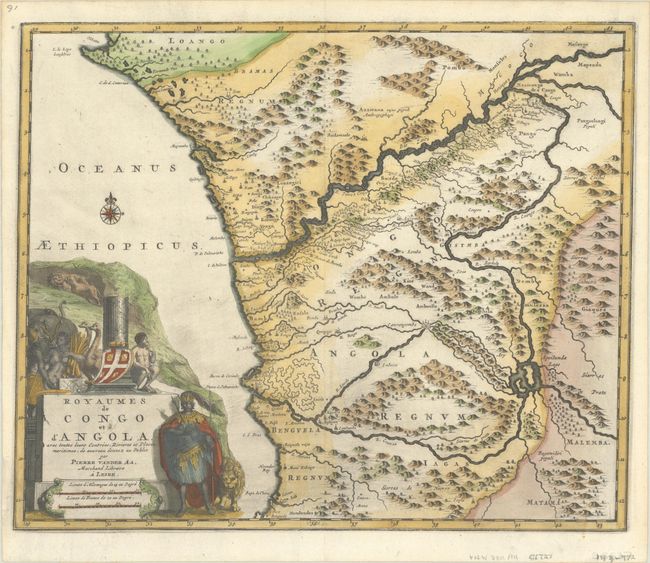
“Royaumes de Congo et d'Angola, avec Toutes Leurs Contrees, Rivieres et Places Maritimes, de Nouveau Donnez au Public”
Map Maker:
Pieter van der Aa
This attractive map covers the Portuguese colonies... (full text available to subscribers)
| Item Detail |
| |
| |
MapMaker: |
Pieter van der Aa
|
|
| |
| |
Subject: |
Western Africa |
|
| |
Period/Size: |
1727 / 11.3" x 13.5" (28.7 x 34.3 cm)
|
|
| |
Color: |
Colored
|
|
| |
Condition: |
(A) A dark impression on a bright sheet with a watermark of the Amsterdam coat of arms and a little printer’s ink residue. (condition help) |
|
| |
Source: |
Voyages Celebres et Remarquables faits de Perse aux Indes Orientales |
|
| |
References: |
|
|
| |
|
|
| Sales Information |
| |
| |
Price: |
|
|
| |
| |
Offered by: |
Old World Auctions |
|
| |
Catalog: |
Auction No. 193 - Antique Maps, Charts, Atlases & Globes (9567) |
|
| |
Lot/Item #: |
685 |
|
| |
| |
Date: |
07/2023
|
|
| |
| |
|
Antique Maps - Valuation and Pricing, Descriptions, Resources |
|
Home |
Information |
Search |
Register |
Contact Us |
Site Map
Americana Exchange, Inc. © 1999 - 2024 Americana Exchange, Inc.. All rights reserved.
OldMaps.com, the OldMaps.com logo and
AMPR are service marks or registered service marks of Americana Exchange, Inc..
|