| Item Detail |
| |
| |
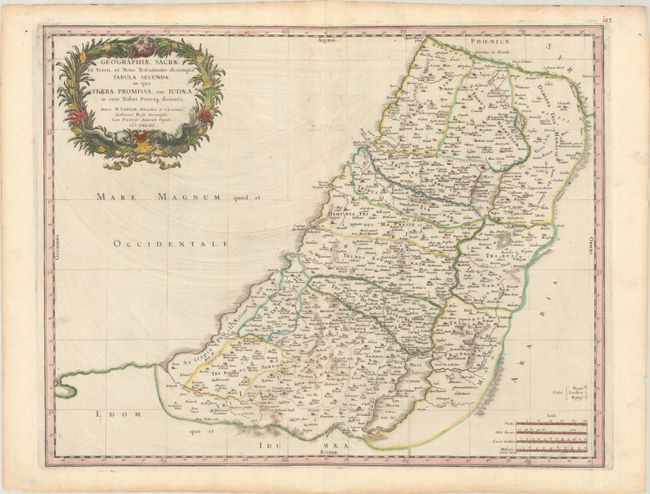
MapMaker: |
Nicolas Sanson
|
|
| |
| |
Subject: |
Holy Land |
|
| |
Period/Size: |
1662 / 15.4" x 19.6" (39.2 x 49.8 cm)
|
|
| |
Color: |
Colored
|
|
| |
Condition: |
(B+) A dark impression on a bright sheet with the watermarks of a large coat of arms and the initials "PF." There is printer's ink residue, particularly in the Mediterranean, some extraneous creasing, and light toning along the edges of the sheet. (condition help) |
|
| |
Source: |
Cartes Generales de Toutes les Parties du Monde… |
|
| |
References: |
Laor #689; Pastoureau, Sanson V B [170]. |
|
| |
|
|
| Sales Information |
| |
| |
Price: |
|
|
| |
| |
Offered by: |
Old World Auctions |
|
| |
Catalog: |
Auction No. 193 - Antique Maps, Charts, Atlases & Globes (9567) |
|
| |
Lot/Item #: |
605 |
|
| |
| |
Date: |
07/2023
|
|
| |
| |
|